Welcome to Jamalpur the world’s most beautiful place! Munger, Bihar
Welcome to Jamalpur ||Munger, BiharGeography
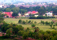
Geography
Jamalpur is located at [show location on an interactive map] 25°18′N 86°30′E / 25.3, 86.5.[1] It has an average elevation of 151 metres (495 feet).
The town is in the Munger district. Munger is 8 km North West of Jamalpur. There is a road as well as a rail link between the two towns. It is an overnight journey from Calcutta.
The nearest airport is at Patna from where Jamalpur is around four hours by Rail. Alternatively, on the Eastern side Kolkata is the nearest airport from where Jamalpur can be reached by Rail. Jamalpur also has a small airstrip.
Demographics
As of 2001[update] India census, Jamalpur had a population of 200,659. Males constitute 53% of the population and females 47%. Jamalpur has an average literacy rate of 83%, higher than the national average of 59.5%: male literacy is 88%, and female literacy is 77%. In Jamalpur, 14% of the population is under 6 years of age.


Leave a comment